Dawson Something
After picking up a part in Regina, and stuffing it in the nose locker so it will be available wherever we are for the next maintenance, I'm going to Dawson Creek. That's Dawson Creek in Northern British Columbia, not to be confused with Dawson City in the Yukon, Dawson's Creek on the WB network, or just plain Dawson all over the place, including a crater on the moon. Yeah, not going to the moon this trip. The O2 bottle only holds about ten hours of supplemental oxygen. The CFS tells me that there are two aerodromes in town, but I am not going to accept dispatch to the one that has a 2000' sloped turf strip and is operated by the Flying L Ranch, so there's no need to call the client to confirm the landing site. The Flying L Ranch sounds like a cool place, but so does the main Dawson Creek airport. It has two separate prepared landing surfaces: one for landing on wheels and one for landing on floats. That is, there's a runway-shaped water-filled trench to the left of the main runway. There's no tower, but the mandatory frequency there is remoted to Peace River radio from 1330Z to 0530Z, which means that when I call, a guy in Alberta will answer.
Weather looks agreeable between hither and yon, despite a steep pressure gradient so I depart, with the addition of another crew member who happens to have been working in the area on his other job, making it an easy pick up. I'm not quite sure what happened to his vehicle. I know a pilot who can tell you off the top of her head how much it costs to ship a car by train from one part of the country to another. Others just own semi-abandoned cars in various places. There ought to be a special pilot car insurance rate for people who only get to use their cars when they aren't flying in another province.
The fuel number is listed in the CFS under "Military" for some reason. Maybe I misread it. They agreed to sell us fuel even though we carry no firearms or bombs, and came fairly quickly.
Dawson Creek is north and west of here. I flew and he manned the charts and radios. We passed fairly close to Saskatoon, so gave them a call to position report and update the weather. I initially just tuned the YXE ATIS for a local altimeter setting, but it was almost an hour out of date and it's always good to talk to someone en route; the FSS will volunteer SIGMETs and other hazards. We check the charts carefully looking for the new boundary between Edmonton and Winnipeg Radio before we call. We identify ourselves and position report, saying we are VFR between Regina and Dawson Creek. Our request is very standard "an altimeter setting and current weather at destination." We at first assume we have a Winnipegger on the line, as he had to ask for the ident of the reasonably large airport that is our destination, but then the conversation got weirder.
Us: It's Yankee Delta Quebec.Him: Dawson Creek altimeter two nine nine three.
Us: [Silence]
Him: Did you want the rest of the weather?
Us: Yes please
Him: [reads entire METAR for YDQ]
Us: Thank you
Him: [Silence]
Us: [to each other] He's not going to give us a local altimeter setting?
We call back and ask for a local altimeter setting and he provides one. That probably doesn't sound weird to most people, but usually you can't talk to an FSS without being given at least one, and often a whole string of altimeter settings for the route ahead. An altimeter setting is the FSS version of "hello." It was especially relevant that day because of the rapid change in setting along our route. Newbie, I guess.
We could see we would clip the edge of Edmonton's control area. I gritted my teeth as I reached for the CFS, hoping that they weren't one of the zones that have started demanding advance codes for transit. I'm going to have to start making that a part of my VFR flight planning now. I look at where I'm going and where I'm coming from, but I am too often guilty of assuming that the old rules apply for VFR transit. Calgary, I learned the hard way, insists on an advance telephone call for a transponder code. Edmonton, fortunately, doesn't yet, but I promise to check each new edition of the CFS before each planned transit through their airspace. We looked up the appropriate frequency for Edmonton Terminal and let them know where we were and where we were going. No problem. They gave us a squawk code (and an altimeter setting) and cleared us through their airspace. We saw three different airports we've worked out of in the last year or so and then we passed out of their airspace to the north and they cleared us en route to squawk VFR. And updated our altimeter setting.
I was flying at 6500', a VFR altitude appropriate for going west, high enough to be out of the daytime turbulence but not so high as to require oxygen or turning on the heater. As I continued east a layer of daytime cumulus cloud was starting to form, building to just about my level. I dodged a few, and then as the layer thickened, mused about my choice, "Up or down? the eternal question." Down would put me into more turbulence, closer to control zones and terrain. Up requires me to increase the power for the climb and then readjust everything again, and the cumulus tops will build another couple of thousand feet before destination, requiring me to do it all over again. Pilots, if you haven't gathered already, can be really lazy. You want me to move levers? It's not a really difficult choice, just a topic of conversation. Pilots can be hard up for those, too. I got a new altimeter setting form flight services. It is higher, good news weatherwise, but putting in a higher altimeter setting shows me at a higher indicated altitude. If I descend again to an indicated 6500' feet I'll really be in the cloud tops. So I take the head start and climb to 8500'.
This works fine for a while, and then the clouds, as predicted, build back to my level. By this time I'm in the vicinity of Grande Prairie. We won't be in their zone, but call them for traffic advisories anyway. Their new altimeter setting puts me back in the tops again, so I descend back to 6500', which is now cloud-free, thanks to the fact that cloud bases tend to gradually rise during the day, and that my new 6500' is a few hundred feet below my old 6500', thanks to the rising pressure. People who have blindly memorized "from high to low, look out below" without close regard for the underlying physics may need to stop and ponder that for a moment. We report the altitude change and call clear as we continue to the west. They thank us for checking in. It's good when towers do that. Sometimes pilots are ambivalent about calling an air traffic agency we don't have to, and when the controlling agency's response sounds like we've bothered them or that they couldn't care less, it results in subtle pilot behaviour modification. But every one who acknowledges the utility of just knowing there's an airplane out there beyond their sphere of control reinforces our motivation to call.
Now we're almost at Dawson Creek. We call the FSS and the guy in Peace River answers us, as advertised. He can't see the traffic out here in BC, but he keeps track of it. There's someone in a single departing, something else small and slow arriving, shouldn't be any conflicts. Then a medevac faster than us checks in behind us. We're almost overhead and hear a five miles out call. Is this going to work out? Oh phew that five mile call was the slow, departing traffic, not the incoming medevac. We land, after jokingly lining up on the water runway for a photo op, then call clear and taxi for fuel.
It's a more civilized-looking airport than we expected. It has a classy new passenger terminal with a big yellow "secure area" square painted on the apron outside of it, a little tower building (probably vacant, seeing as the radio service is remoted to Alberta) and lots of paved apron. There are two fuel pumps either side of a sign that gives prices (good prices, too) for avgas and jet, but while the right tank has a Jet A sticker on it, there is no avgas marking on the left tank. Weird. The paper cover of the journey log tears on the seat pocket as we take it out to record the flight. Grr. I always buy the hardcover version when I have a choice. But they keep replacing this one before it's full, dunno why.
We unload the airplane and I give the receipts for the ferry fuel to the customer: they are responsible for that. The Regina receipt is just a truck fuel ticket, not a credit card receipt, because the truck driver didn't process the credit card, just called in the information. Client needs a proper receipt. I didn't bring a CFS in from the plane, but the fuel number is in the recently called list in my phone. They fax a copy of the credit card receipt and everyone is happy.
Dinner is at some chain restaurant where they casually offer you garlic bread with your entree, then charge you $3.50 for it. One slice.
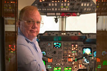
I did get a chance to call the airline captain who was one of the first to encourage me in all this. As I was approaching Regina, he had been just leaving, ferrying a smaller airplane in the other direction. I believe that brings his home collection of aircraft to five. He's well, just retired, still happily married to his original wife, and having a great time. I'll see if I can get out to see him when work and other aspects of life let up around ... January I think.
Labels: ATC, costs, flight plans, food, fuel, landing, paperwork, pressure, publications, safety, weather
posted by Aviatrix at 00:00
As always, flying aircraft around Canada can be a challenge, even for more experienced pilots.
JetAviator7